|
.
AUSTRALIA'S
GREAT ARTESIAN BASIN

INDEX
The
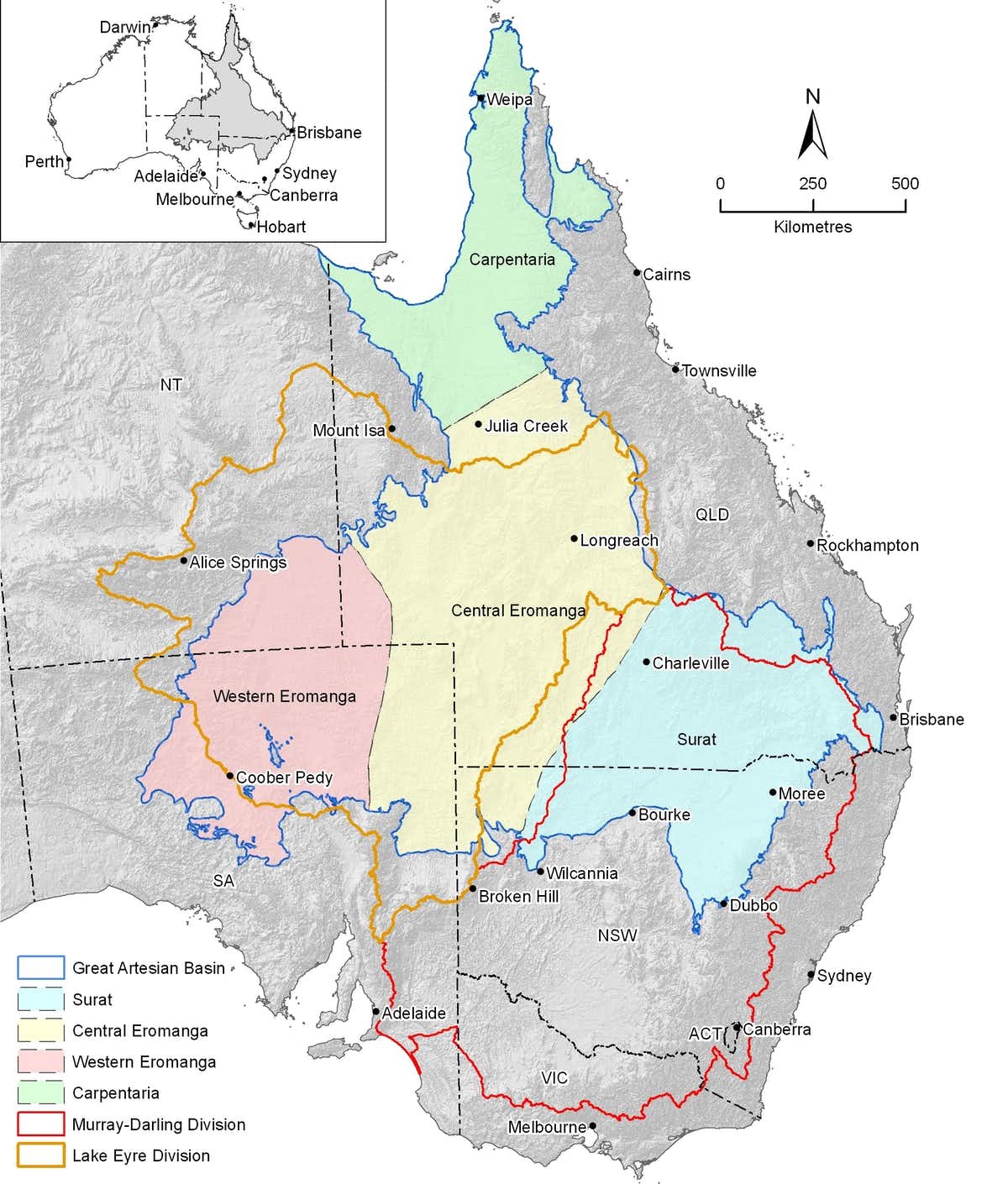
Great Artesian Basin (GAB) is one of the largest underground water reservoirs in
the world. It underlies approximately 22% of Australia, occupying more than 1.7
million square kilometres beneath the arid and semi-arid parts of Queensland,
New South Wales, South Australia and the Northern Territory.
Water
emerges naturally from the Basin through cracks in the rock encasing the water,
into springs, shallow water tables or into creeks and rivers creating a
permanent water source even during dry periods. Most springs and leakages occur
on the edges of the Basin where water is close to the surface.
It
was recognised by the early 1900s that control over GAB groundwater was
inadequate and there was a reduction in water pressure and volume due to the
increasing number of bores drilled that were allowed to flow uncontrolled into
open drains and creeks for distribution to stock. However, even in
well-maintained drains up to 95% of this water can be wasted through evaporation
and seepage.
Uncontrolled
flow from bores and open earth bore drains in the GAB threatens the health of
important groundwater-dependent ecosystems and continued access to artesian
water by pastoralists.
In
addition, it has become difficult for new water users in or near the GAB to
obtain access to groundwater resources.
The
waste of water is causing environmental damage through:
 |
reduced
pressure in some naturally occurring artesian springs
|
 |
encouragement
of the spread of pest plants and animals
|
 |
land
and water salinisation
|
The
common-sense solution to recharge the
entire
Great Artesian Basin was obvious.
The
Bradfield Scheme proposed in 1938
required large pipes,
tunnels, pumps and dams. It involved diverting water from the upper
reaches of the Tully,
Herbert
and Burdekin
rivers. These Queensland rivers are fed by the monsoon, and flow east to
the Coral
Sea. It was proposed that the water would enter the Thomson
River on the western side of the Great
Dividing Range and eventually flow south west to Lake
Eyre. An alternative plan was to divert water into the Flinders
River.
It
is claimed that extra water and vegetation
in the interior may then produce changes to the climate
of Australia, however various studies have concluded that this is
unlikely. This may increase the rainfall in areas of southern Queensland
and northern New
South Wales. Extra rainfall may drought-proof Eastern Queensland, and
thereby improve river inflows to the Murray-Darling
River system. It
is claimed that a full Lake Eyre would moderate the air temperature in the
region by the absorption of sunlight by the water instead of heat radiation from
dry land into the air. No evidence to support the theory that an inland sea
would increase rainfall has ever been produced, nor have any of the other claims
been supported... until now!
In
the book "The
Great Boomerang" by Ion
Idriess, it is reported that on two occasion when Lake
Eyre filled up with floodwater, the eastern seaboard reported good
harvests for the preceding seven (7) years.
RETURN TO:
BRADFIELD SCHEME
| ![]()
![]()


